Udell Engineering
& Land Surveying, LLC

63 East Ash St.
Lebanon, Oregon 97355
tel 541.451.5125
fax 541.451.1366
Owners: Brian & Amy Vandetta
63 East Ash St.
Lebanon, Oregon 97355
tel 541.451.5125
fax 541.451.1366
Owners: Brian & Amy Vandetta

63 East Ash St. Lebanon, Oregon 97355 tel 541.451.5125 fax 541.451.1366
Owners: Brian & Amy Vandetta
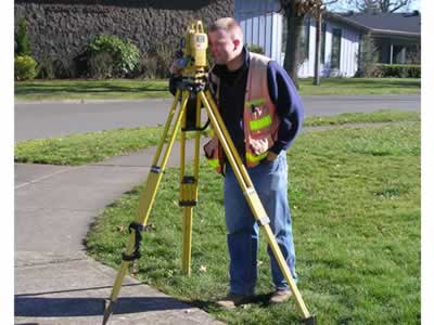 Surveying is a highly technical field that requires expertise in real estate property law, public records search, evaluation of historical survey evidence, Land Survey Law, mathematics, statistics, measurement systems, planning regulations and current computer technologies.
When you choose Udell Engineering & Land Surveying, LLC to help you through all those complexities you can rest assured that your interests will be well protected.
Here is a description of the services we provide:
(Also known as A.L.T.A. Survey or Extended Title Insurance Coverage)
We will provide a title company or lender with a survey and location data for the issuing of American Land Title Association or Extended Coverage Title insurance. This survey will show the relationships of existing improvements on a parcel of land relative to the boundaries as defined by the title report. (A.L.T.A. or American Land Title surveys may require a boundary survey.)
We use both record and field research, including measurements and computations to set property corners and boundary lines of a given parcel of land in accordance with state law. Easement lines and encroachments may also be located when we do this type of survey.
Our objective is to provide you or your construction personal with directions (by way of staking or other notes) for erecting improvements shown on plans for construction. This could include improvements such as roads, buildings, and pipelines.
Elevation Certificates are prepared to provide data to insurance companies, lending institutions, and government officials for property and structures in or near a flood plain.
This is a survey which combines boundary and topographic surveys for site plan preparation to be used for designing improvements or developments prior to construction. This survey is often required as part of a development plan in conformance with local and state law.
We provide documentation required to subdivide or partition a tract of land into smaller lots or parcels, which show the property corners and survey data on a map in conformance with local and state law.
The purpose of a control survey is to establish precise horizontal and vertical positions of points on the ground for use in boundary determination, mapping from aerial photographs, constructions staking and other related purposes.
A property line adjustment procedure is used to relocate existing common property lines between two abutting lawfully established lots of record. No additional lots may be created.
When we do a topographic survey, we will locate topographic features of the land—natural and man-made. For example;
This type of survey may be required by a governmental agency or maybe used by engineers and/or architects for design of site improvements or developments.
A topographic survey is also an excellent management tool for large tracts of forest land. Such a survey is not necessarily limited by property boundaries.
Please call 541.451.5125 and ask one of our experienced personnel. We are here to serve you.